On September 12, 2007 - first oil tank docked in Giurgiulesti
18:14 | 11.09.2021 Category:
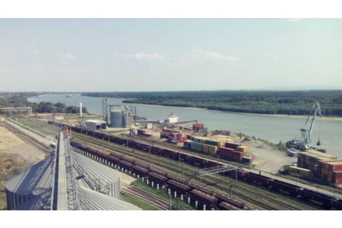
At the confluence of the Danube and Prut rivers, the Republic of Moldova has its only accessible port for large river and sea vessels. The depth of the Danube water reaches 7 meters in this place.
The history of the "acquisition" of the part of the Danube coast by our country is a tangled one and shrouded in mystery. The establishment of administrative boundaries between the Ukrainian SSR and the Moldovan SSR in 1940 was voluntary and dictated by geostrategic and even military reasoning. During the Soviet period, these borders did not have any impact on the existence of these union entities.
After the proclamation of independence in 1991, Moldovans were not concerned with establishing a state border with Ukraine. Moldova was heavily involved in the conflict in its eastern districts and was making desperate efforts to stabilize its political and economic situation.
When the negotiations between the Republic of Moldova and Ukraine started, there were several question marks regarding the affiliation of the territory, called “Râpa de la Mândrești”, to the east of Giurgiulesti, which has an indefinite status. According to the Ukrainian position, it was a Ukrainian territory that could be ceded to the Republic of Moldova in exchange for territories located within the communes of Crocmaz and Palanca. According to international law, however, "Râpa de la Mândrești" was de jure already Moldovan, given that from August 1940 (when the border between the MSSR and the SSR was established) until 1992 (when the Moldovan and Ukrainian prime ministers Valeriu Muravschi met and Pavel Lazarenko), the border crossed to the east of “Râpa de la Mândrești”, which was part of the Giurgiulesti commune.
Following the complicated Moldovan-Ukrainian negotiations, a compromise was reached by signing an additional protocol in 1999 by which the Republic of Moldova will transfer to Ukraine the land included in the Nișaliu river loop located within the commune of Crocmaz (107.7 ha), road sector. Reni-Odessa located within the commune of Palanca with a length of 7.77 km, a width of 23 m and an area of 18 ha, with the corresponding basement, as well as the parts of the communal estate located south of the road, namely Piscicola, Pășunea, Abdiv and Baibol (9.26 km2), forming a total of 10.5 km2, in exchange for a corresponding territory located between the communes of Giurgiulesti in the Republic of Moldova and Reni in Ukraine, territory comprising a portion of the shore along the Danube River ”. Thus, the Republic of Moldova became the owner with proper documents of a segment of 450 meters of Danube coast.
Our country, through the access to the Danube, obtained the possibility to build its first and only port that allows it to obtain the status of Danube and riparian country of the Black Sea.
In 2000, the construction of the port began. In 2006 the works were completed. The port has been granted the status of Free International Port, one similar to the free economic zone.
The port also has a passenger capacity, which is limited to a few hundred people a day.
The Giurgiulesti Free International Port benefits from a connection with international trade and transport routes, such as the Rhine-Main-Danube waterway, which connects the Black Sea, 14 European states and the North Sea; European and Russian standard railway systems, as well as the international road network. The services of this port are used annually by companies from over 50 countries, and the Republic of Moldova enters the regional and international maritime-fluvial circuit.
Photo: agora.md